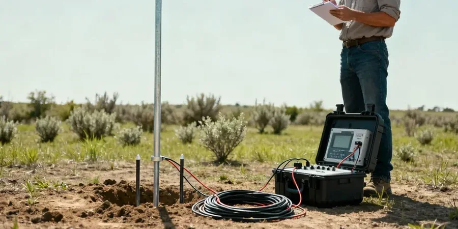
Crossing from the historic French Park neighborhood over to the industrial corridor south of Edinger Avenue, the subsurface changes more than most residents realize. The older residential pockets sit on natural sandy loam terraces left by the ancestral Santa Ana River, while areas closer to the modern channel encounter buried paleochannels and higher groundwater that complicates foundation design. Soil borings alone give point data, but Electrical resistivity / VES (Vertical Electrical Sounding) fills the gaps between them, mapping how resistivity shifts laterally and with depth. In Santa Ana, where the water table often sits within 15 feet of the surface in the central basin, a resistivity profile can distinguish saturated sands from dry overburden without a single excavation. The technical team runs a Schlumberger array with precise electrode spacing, feeding inversion models that highlight low-resistivity zones tied to perched water or clay lenses. For projects near the Santa Ana River, where floodplain deposits vary over short distances, combining a resistivity survey with test pits verifies the stratigraphy at select control points while the geophysics covers the broader site.
A resistivity survey in Santa Ana can map the freshwater-saltwater interface and buried channel deposits before a single borehole is drilled.