GEOTECHNICALENGINEERING1
SANTA ANA
HomeGeophysicsMASW / VS30 (shear wave velocity)

MASW & VS30 Testing in Santa Ana, CA

Geotechnical engineering with regional judgment.

LEARN MORE

In Santa Ana, working with the shallow groundwater and alluvial basin deposits that cover much of the city requires more than just a standard boring log. The USGS Quaternary mapping shows a patchwork of young alluvium, older terrace deposits, and fine-grained basin fill — each with a different stiffness profile that directly controls how ground motion amplifies during an event. We regularly see that two sites less than half a mile apart can yield site classes C and D, and that difference carries a 20% to 40% swing in the design base shear. For structural engineers filing under the current IBC and ASCE 7-22, a site-specific shear wave velocity profile is the only way to avoid defaulting to the conservative assumed class and overdesigning the lateral system. When the stratigraphy gets tricky — interbedded silts and sands that don't read cleanly on SPT alone — we pair the surface wave data with CPT soundings to anchor the Vs profile to a direct penetration log, giving the geotechnical reviewer a defensible, internally consistent site characterization package.

In Santa Ana's alluvial basin, the difference between Site Class C and D can shift the design base shear by 30% — and only a measured Vs30 profile catches it reliably.

Our service areas

Methodology and scope

A mid-rise mixed-use project near Main Street encountered exactly this problem: the borings hit dense sand at 30 feet, suggesting Site Class C, but the contractor's instinct said the upper 15 feet felt looser. We ran a 69-meter MASW line along the future building footprint, using 24-channel 4.5 Hz geophones and a 10-lb sledge source, and processed the dispersion curves with a multi-mode inversion. The result showed Vs30 at 245 m/s — firmly Site Class D — driven by a 12-foot lens of soft silty sand that the SPT sampler had blown through before the hammer energy could tell the full story. This kind of scenario is why the ASCE 7-22 commentary explicitly encourages site-specific Vs measurement in basins with known velocity reversals. In Santa Ana's older commercial corridors, where redevelopment sits on fill over Santa Ana River alluvium, the same lensing effect shows up repeatedly. We often complement the surface wave array with a seismic refraction line when the site geometry allows it, cross-checking the P-wave and S-wave velocity models to separate stratigraphic boundaries from water table effects — a distinction that matters enormously in this part of Orange County, where the groundwater can be within 10 feet of grade.
MASW & VS30 Testing in Santa Ana, CA
Technical reference — Santa Ana

Site-specific factors

The IBC 2024, adopted by California with Orange County amendments, ties the seismic design category directly to the site class — and when a project defaults to Site Class D without measured Vs data, the structural engineer is forced into a more punitive set of detailing requirements. In Santa Ana, where the mapped NEHRP class often defaults to D across the basin, a site-specific MASW campaign that demonstrates Site Class C can eliminate the need for special moment frames in some occupancy categories, saving six figures in steel tonnage and connection fabrication. The real hazard isn't just the cost penalty; it's the performance uncertainty. Santa Ana sits on the northern flank of the Santa Ana structural trough, and basin-edge effects can focus long-period energy in ways that uniform-hazard spectra don't capture well. A blind reliance on SPT N60 correlations — which carry a coefficient of variation exceeding 25% in silty sands — leaves the design team exposed to a velocity profile that's simply wrong. The liquefaction triggering analysis that follows from the same investigation demands a consistent Vs framework, especially in the zones near the Santa Ana River where the groundwater table sits high and the fines content fluctuates over short distances.

Need a geotechnical assessment?

Reply within 24h.

Email: info@geotechnicalengineering1.biz

Reference standards

ASCE 7-22: Minimum Design Loads and Associated Criteria for Buildings and Other Structures, IBC 2024: International Building Code, Chapter 16 (Structural Design) and Chapter 18 (Soils and Foundations), ASTM D7400-19: Standard Test Methods for Downhole Seismic Testing (surface wave methods referenced), NEHRP Recommended Seismic Provisions for New Buildings and Other Structures

Typical values

ParameterTypical value
Test MethodActive MASW, 24-channel linear array
Geophone Frequency4.5 Hz vertical-component
Investigation DepthTypically 30 m (100 ft) for Vs30; configurable to 40 m
Source TypeSledgehammer (10–16 lb) on aluminum plate; weight drop for deep targets
Data ProcessingMulti-mode spatial autocorrelation and dispersion inversion
Key Output1D Vs profile, Vs30 value, NEHRP Site Class per ASCE 7-22 Table 20.3-1
Applicable StandardsASTM D7400, ASCE 7-22, IBC 2024

Common questions

How much does a MASW / Vs30 survey cost for a typical Santa Ana commercial lot?

For a standard commercial parcel in Santa Ana — roughly 0.5 to 2 acres — the MASW survey with a single array line, dispersion processing, and the signed Vs30 report runs between US$1,860 and US$3,550. The spread depends on site access, the number of array setups required to cover the building footprint, and whether we're coordinating with concurrent drilling or CPT work. A constrained-access site with limited line length will push toward the upper end because it forces multiple short arrays with lower signal-to-noise ratio.

Does the City of Santa Ana accept MASW in lieu of downhole seismic for site classification?

Yes — the Santa Ana Building Division and most Orange County plan-check reviewers accept active MASW per ASTM D7400 as a valid method for determining Vs30 and NEHRP Site Class, provided the report includes the dispersion curves, inversion parameters, and a clear correlation to any available borehole logs. We've submitted dozens of MASW-based site classification packages in the city, and as long as the metadata is transparent, they move through review without pushback.

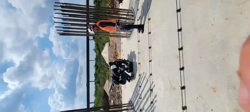
How deep does the MASW array need to reach for a reliable Vs30 measurement?

To compute Vs30 per ASCE 7-22, we need a Vs profile to at least 30 meters (100 feet). A 24-channel array with 3-meter geophone spacing typically resolves to 25–35 meters, depending on the stiffness of the shallow layers. In Santa Ana's softer alluvium, we often get clean dispersion down to 35 meters with a sledge source. If the site is particularly stiff — say, on the older terrace deposits near the eastern edge of the city — we'll switch to a weight-drop source or extend the array length to push the investigation depth past 40 meters.

What's the difference between Vs30 from MASW and Vs30 estimated from SPT N-values?

SPT-based Vs estimates use empirical correlations that carry significant scatter — typically a coefficient of variation of 25% to 40% in the silty sands common across Santa Ana. MASW measures Vs directly from surface-wave dispersion, so it's not relying on a proxy. In our experience across Orange County, the SPT correlation can misclassify a site by one full class, especially when thin soft layers are hidden between denser strata. The IBC commentary explicitly favors measured Vs over correlated values, and structural engineers increasingly require it for performance-based designs.

How long does the field work and reporting take for a Santa Ana MASW survey?

Field acquisition for a single MASW line takes about 2 to 3 hours on site, assuming reasonable access and no major buried utilities that require extra clearance. The data processing — picking the dispersion curve, running the inversion, and generating the 1D Vs profile — is another 2 to 3 days in the office. The final signed report, including the Vs30 calculation, site class letter, and the processed field records, is typically delivered within 5 business days from the field date.

Location and service area

We serve projects in Santa Ana and surrounding areas.

View larger map